Friday 6 September 2013

Maritime Alps - Maps and Guide books


In Italy we used:

Carta Dei Sentieri e dei Refugi 1:25000 
113 Parco Naturale Alpi Marittime Entracque Valdieri Mercantour Gelas.


In France we used:

IGN (Institut Geographique National) 

3841OT  Vallee de la Roya, Vallee des Merveilles


3741OT Vallee de la Vesubie


3741ET Valles de la Bevera et des Paillons


There are two Cicerone guides that provide useful information on the area.


Walks and Treks in the Maritime Alps, by Gillian Price.


The GR5 Trail, by Paddy Dillon


Thursday 5 September 2013

Maritime Alps - Summary


Here is a summary of our itinerary.

From
To
Via
Mode of Travel
Ascent
/m
Descent
/m
Accomodation
Home
Paris
London
Train
N/A
N/A
Hotel In Paris
Paris
Entraque
Turin, Cuneo
Train, Train, Bus, Foot
N/A
N/A
Camping
Entraque
Entraque
Explored the village
Foot
N/A
N/A
Camping
Entraque
Rif Questa
Term di Valdieri
Hitched and on foot
1050
?
Rif. Questa
Rif. Questa
Rif Remondino
Col. Di Valasco, Piano della Casa,
Foot
1172
1004
Rif. Remondino
Rif Remondino
Rif. Genova Figari
Col. Di Broccan
Foot
482
947
Rif. Genova Figari
Rif Genova Figari
Rif Soria Ellena
Col. Di Finistrelle
Foot
611
774
Rif Soria Ellena
Rif Soria Ellena
Ref. Nice
Col. Di Finersta 1903, Pass du Mont Colomb 2548m, La Barme 2150m
Foot
1228
838
Ref Nice
Ref. Nice
Ref. Valmasque
Baisse du Basto 2693m
Foot
667
679
Ref. Valmasque
Ref. Valmasque
Ref. Valmasque
Col. Charnassere 2727m, Pas de Faus 2828m
Foot
901
888
Ref. Valmasque
Ref. Valmasque
Ref. Merveilles
Baisse de Valmasque 2549m
Foot
467
576
Ref. Merveilles
Ref. Merveilles
Wild camp Tete de Gais
Cime du Diable 2685m, Baisse Cavaline 2107m, Col de Raus 1999m, Baisse de St Veran 1836m, Pointe de Trois Communes 2080m, Baisse de Ventabren 1862m, Baisse de Dea 1750m, Mangiabo 1821m, Tete de Gais
Foot
1086
1699
Wild camp Tete de Gais
Wild camp Morga
Baisse de la Liniere 1342m, baisse de Figuiera 760m, Sospel 354m, col de Razet 1032m
Foot
865
1482
Wild camp Morga
Wild camp Morga
Menton
Col de Bercea 1090m, Plan de Lion 720m, Garavan 0m
Foot
398
1256
Camp site Menton
Menton
Monte Carlo
Coast path
Foot
N\A
N\A
Camp site Menton
Menton
Home
Paris, London
Train
N\A
N\A
Home

Sunday 1 September 2013

Maritime Alps - Cime du Ters to Morga

Sospel
Sunday 1st September

We slept well on our private campsite. No noisy neighbours here.
The first col of the day was Baisse de la Liniete (1342m). We walked downhill all morning, mostly through pine woodland and mixed deciduous lower in the valley around Baisse de Figuera (750m) finally reaching a road and paths that took shortcuts into Sospel.

Sospel is a pleasant town with a river running through the middle and a distinctive old footbridge. We stopped for lunch and sat by the river to eat.

Dry rough terrain of the southern part of the GR52


The GR 52 is clearly marked out of town crossing a railway line and some short cuts across the road which is soon left behind once more. The path climbs steadily through shaded woods to l'Albarea and out into. Clearing by a water trough where we rested in the shade for a snack. This was the last water supply before Menton.

Our first view of  the Mediterranean
Some height is then lost to cross the Ravin de Roulabre and several side valleys; all dry. The path climbs steeply to Col du Razet 1032m with a view of the Mediterranean Sea in the heat haze. After the col the path levels out for a while before climbing up to Colla Bassa through dense trees.

The path takes a right turn down a rough track to a muddy bend where a narrow path turns off on the right at 969m. The path passes a small house in the left with a satellite dish. A little further on the route crosses to the other side of the valley where we camped on an abandoned field terrace.

Ascent 865m
Descent 1482m


Abandoned terraces make good camping spots
with the Med in the distance
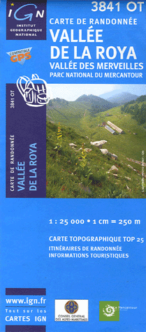