Saturday, 31 August 2013

Maritime Alps - Refuge des Merveilles to Tete de Gais near Sospel on the GR 52

Lac du Trem on route to Cime du Diable
Saturday 31 August 2013

We had a long day ahead and planned to reach a summit today so we headed towards Pas de Trem 2480m, passing several small lakes on the way. We diverted from the GR52 at Lac du Diable and headed for the Pas de Trem so that we could go over Cime du Diable 2685m and then follow the crete South to Baisse Cavaline 2107m where we could rejoin the GR52.


Cime du Diable


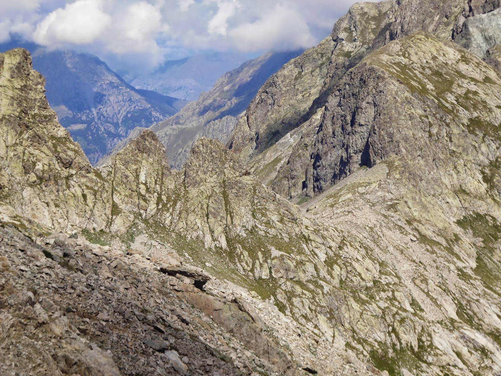
The top of Cime du Diable was well worth the extra climb and the Crete made a super route gradually dropping and becoming less rugged as we approached Baisse Cavaline. From here the path is an easy high level route to Col de Rous (1999m) then on to Baisse de St. Veran (1836m).


GR52 Between Col du Raus and Baisse de St Veran looking south


We stopped for lunch at the hill fort on Pointe de Trois Communes (2080m).

After the fort we took the old route of the GR 52 past the abandoned military barracks on Plan Caval where we joined a Tarmac road (encountering the first car for 8 days) for 1.5km to a sharp bend at spot height 1793m, where we took a forest track south, then at spot height 1802m we took the grassy path  that went up a ridge to the east of Mont Giagiabella 1911m.

Looking back along the route of the GR52.
Fine ridge walking for miles!


Then we briefly rejoined the track before taking a path forking left at spot height 1885m uphill, then down to Baisse de Ventabren 1862m. The path swapped to the east of the next top, Pointe de Ventebren on an easy path to Baisse de la Dea 1750m.


Our camping spot on Tete de Gias


The path swapped back to the west side again on a rocky path below Cime de la Gonella.  We then took the path leading directly up Mangiabo 1821m, then followed a sharp right NW back to the GR 52. The path soon turned left down across a steep slope to Tete de Gais where we pitched our tent on a rough grassy spur below Cime du Ters.

Ascent 1086m
Descent 1699m


Sunset trough the tent door

Friday, 30 August 2013

Maritime Alps - Refuge Valmasque to Refuge Merveilles

View south from Baisse de Valmasque looking down Vallee des Merveilles 
Friday 30th August 2013

A relatively short and easy walk today from Refuge de Valmasque (2233m) to Refuge des Merveilles.(2130m) via Baisse de Valmasque (2549m)

We set off about 8.00am and took our time, retracing our steps from Wednesday past the three lakes heading south west to Baisse de Valmasque (2549m).

We had some good close sightings of young male chamoix between lac du Basto and Baisse de Valmasque. The ascent up to the pass was gentle and easy underfoot and gave us a good view north to lac de Basto.

The famous rock carving, Le Christ, in Vallee des Merveilles
We hardly noticed the climbing and were soon dropping down into Vallee des Merveilles, a beautiful valley with a path meandering between little lakes and folling the connecting stream.

The valley narrows to a tight gorge at one point betweenle Chef de Tribe and le Christ; rock carvings that date back to the Bronze Age. The carvings are closely guarded, with only a few easily accesible without paying for a local guide.

After the gorge the valley opens out and the path turn to the south of Le lac Long Superior, where Refuge Merveilles stands close to the barrage.

Ascent 467m
Descent 576m

Thursday, 29 August 2013

Maritime Alps - Circular walk from Refuge Valmasque to Collet de la Charnassere

Thursday 29th August

Le Lac Gele
This was supposed to be a rest day. The only  element that made it any easier was that we were not carrying all the gear in our rucksacks.

It was a beautiful morning so after breakfast we crossed the dam behind the refuge Valmasque (2233m)  and followed the the cross country ski route. that heads up to Le Lac Gele.


Le Lac Gele


It is a super route on rock with some easy scrambling sections. Once in the cwm we crossed the strip of ground between the small and large portions of lac Gele (2588m).

We then crossed the scree on the north side of the lake on an indistinct sheep/chamoix track then climbed steeply at the end of the lake up to Collet de la Charnassere (2727m).
The col gave good views across to the border and lac de l'Agnel.

After a bite to eat we took a clearer path south to Pas de la Fous (2828m), fine broad col.

Collete de la Charnassere tot he left with Le lac Gele in the centre
From here we edged along the sharp arete to a small top to gain a better view. After returning to the col we took the main path down from the col on the east side stopping at Lac de la Lusiere. for a snack while we sat there an ibex came to within 5m of us.

Continuing down to the dam for Lac Noir (2278m) was mostly on solid rock with a few patches of snow that were soft enough to grip. We then returned to Refuge de Valmasque where a nice fire was already lit.

Ascent 900m
Descent 888m


Collet de la Charnassere

Le Lac Gele and Lac de la Lusiere

Rocky ridve south of Pas de la Fous 

Ibex

Wednesday, 28 August 2013

Maritime Alps - Refuge de Nice to Refuge Valmasque via Baisse du Basto

Wednesday 28th August 2013
Near Lac Nire looking west
Self-service breakfast then left at 8.30am for Baisse du Basto, 2693m.

The path weaves its way up the valley initially on an easy path with the occasional rock section, past lac Nice where there are some huge boulders.


Lookin west from Baisse du Basto
The route is clearly marked and passes three more lakes before climbing through solid rock and large boulder scree. The final 2-300m climbs very steeply on loose scree and ice covered rock. The col, Baisse du Basto (2693m) is fairly broad with superb views in all directions.


We scrambled higher on the SW side onto a couple of rocky peaks that had a shelter or look-out post. From the top we had our first glimpse of the Mediterranean coast.

Rocky tops SE of Baisse du Basto
The descent was significantly easier, the path was a gentler gradient and far more stable underfoot. Also there was no verglas as this side had the benefit of the early morning sun to melt the ice. We passed lac Nire, three other small lakes and crossed several snow fields. The snow was quite a surprise as we were so far south and had the Med in our sights!

The final descent to the south of Lac du Basto was a little rougher, crossing large boulders, making our progress slow. Once in the Valmasque valley we headed north on an easy broad path, past 3 lakes (Basto, Noir and Vert) that are infact resorvoirs.

Le Lac Verte with Refuge Valmasque at the far end.


The refuge is located on a rock at the eastern end of Lac de Verte. There are two optional variations for the approach to the refuge. 

The longer one drops to 2205m into the valley below the refuge and is on a track. 

The alternative, shown as a red dotted route on the map, crosses a large glacially smoothed rock. It does not cause any real problems and most people trekking the Alps will have no difficulty with this option if you cannot face dropping down then back up at the end of the day.

We sat on the wooden veranda drinking juice, tea and eating tart enjoying the late afternoon sun.

After our meal we were entertained to some communal singing lead by a ladies choir that were on a walking weekend. They sang mostly British songs from the Beetles etc. so we could join in.

Ascent 667m
Descent 679m


Le lac Verte from Refuge Valmasque


Tuesday, 27 August 2013

Maritime Alps - Rifugio Soria-Ellena to Refugio Nice via Collette di Finestre

Tuesday 27th August 2013


Our route for today was to take us over the Collette di Finestra ((2474m) down to Refuge Madone de Fenestre, from there over Pas du Mont Colomb (2548m) to La Barme  (2173m) and Refuge di Nice (2232m).

Lovely room with a high level double bed and two bunks, to ourselves in Rifugio Soria-Ellena. The route up the valley towards Collette di Finestra (2471m) initially followed a broad track then zig zagged on a stone built track (that are characteristic of the Alpi Marittime) up to some deserted military barracks at the col.

Looking back towards Col de Fenetre from Lac de Fenetre
 On the French side of the col there are two possinle paths down, we took the the one heading directly south on the left leading to Lac de Fenestre passing ibex and chough on the way down. At about 2050m we took a short cut to avoid dropping all the way down to Refuge Madone de Fenestre. We turned off where the path took a sweeping bend with a very prominent boulder down into a dry valley that lead into a grassy flood plain where several streams converge (Gias Cabret). We clambered up the steep opposite bank through some sparce stunted pine trees to join the GR52. We plan to follow this all the way to Menton on the Mediterranean coast.

Approaching Pas de Mont Colomb with the
gendame in the middle. 


The ascent to Pas de Mont Colomb was spectacular. We  crossed several streams that the guide books describe as dry and the little lake was full. The path crosses a couple of rocky scrambling sections requiring hands and also large boulder scree. This is a very popular area with walkers and we were seeing a lot more people than in Italy.

The col is narrow and tight with a gendame and the descent is very steep on the eastern side. It took about an hour to La Barme then an easy 20min walk up the valley to Refuge de Nice. This is a large modern and rather cold refuge, everyone was wearing their fleeces and coats indoors. It rained for the final 10 min of the approach and continued heavily that evening keeping everyone indoors.

Ascent 1228m
Descent 838m


Pas de Mont Colomb

Pas de Mont Colomb

looking back at Pas de Mont Colomb

Lac de la Fous and Refuge de Nice in the distance.
Sorry about the legs


Monday, 26 August 2013

Maritime Alps - Rifugio Genova Figari to Rifugio Soria Ellena via Collette di Fenestrelle

The views back to the Collette di Brocan
with Fifugio Genova Figari in the foreground .
Monday 26th August 2013


Our destination for today was Rifugio Soria Ellena over the Collette di Finistrelle. It follows the Via Alpina and GTA, both long distance routes through the alps.

The path follows the SE shore of the Bacino del Chiotas then joins the M10 over the col.  climbing gently via zig zags below the  Rocce di Laura. It cleverly avoids the rocky outcrops that appear to block the route.


Looking down from Collette di Fenestrelle
 towards Bacino del Chiotas


We encountered a large patch of snow just before the col that was still hard and icy so we took a cairned route across the rock and boulder scree to join the path on the other side of the snow. We saw no one the entire day, this late in the season it is very quiet.
The views back to the Argenterra massif and the Collette di Brocan that we crossed yesterday were spectacular.


Collette di Fenestrelle from the north side


Collette di Finistrelle (2463m) is a wide grassy col, with a snow patch and small pond, but a cold wind was whistling through making it unsuitable for a stop. We carried on to a rocky outcrop marked P. della Lobbie (2322m).  as it gave fine views  of M. Gelas and our route for tommorrow aver the Collette di Finestra.


M. Gelas and our route for tommorrow
over the Collette di Finestra.


The descent into the Piano del Praiet where Refugio Soria-Ellena is located was very easy on grassy paths across flower meadows. All very Sound of Music like!
There  were juniper, beech 9growing as a shrub), azelia and bilberry laden with delicious fruit. a large herd of cows with bells aroun there necks added to the alpine atmosphere. It started to rain as we arrived at the refuge and later the cloud dropped right down into the valley.
All power in the refuge is supplied by a water turbine  so charging our camera and phone was not a problem and they even had heaters.

Ascent 611m
Descent 774m


Piano del Praiet from P della Lobbie

Sunday, 25 August 2013

Maritime Alps - Rifugio Remondino to Rifugio Genova via Collette di Brocan

Sunday 25 August 2013

Breakfast was the usual tea, toasties, bread and jam. We sat and chatted to a couple from the Netherlands and another Swiss couple. Just before leaving we spotted some Ibex licking the mortar between the stone blocks on the patio.


On route to Collettee di Brocan looking back towards Rif Remondino
We set off at 9 am heading east up the scree taking a diagonal line towards the top of a large crag. The streams were in spate after the storm last night and in places it had turned to sheets of ice. The route was clearly marked with small cairns and yellow paint. Turning right (south) at the path junction to Lagi di Nasta we encountered our first  patch of hard icy snow, We were in the shade of Il Bastione so the sun had not softened the snow enough to walk on. We therefore had to make a detour up and over a rocky buttress that also had patches of ice. The route to Collete di Broccan (2892m) headed south below the massive cliffs of Il Bastione. We encountered more large snow patches requiring detours onto boulder scree at the base of the cliffs. Normally the snow would have gone this late in the season but snow had fallen in the early summer and remained due to the cold weather this year.

The col is a superb spot with immense views but the distant peaks were obscured by cloud.
Collette di Brocan (2892m)
Looking down the other side of the col Rif. Genova Figari could be seen 900m below but our immediate attention was drawn to the cwm below that was full of snow and looked impassible. Our hearts sank. Luckily the snow on this east facing side was in the sun and the top few centimetres of snow had melted enough for our boots to bite.
Relieved we crossed with ease, but over the lip there was an even bigger snow field in the next cwm down. We walked across this with growing confidence only to be confronted by a deep bergshrund at the bottom edge. Having slid down this and survived we sat to eat lunch in the sun. We were visited by an energetic stoat keen to collect any crumbs that we might drop.

Snow on the descent from Collette di Brocan
 There appeared to be many conflicting routes marked by yellow paint so it was a matter of picking your preferred route. This was not a place to move quickly, careful foot placement was important to avoid loose rock. The best route keeps to the south side of the gulley down below a ridge leading east fro Cimma di Broccan.

800m down we stood on the shore of Laggo Broccan and a gentle path lead to Rifugio Genova Figari. The refuge is sits on a rock barrier between L. Broccan and bacino del Chiotas, a resorvoir that covered the original refuge. The new one was built in 1970 by the electricity company who built the resorvoir.

We were placed in a two bedded room, one of the advantages of the newer refuges is that the rooms are smaller. Around the refuge there are plenty of flat grassy areas for camping with small groups of chamoix with young ones running around like spring lambs.

We sat by the lake in the afternoon relaxing after the walk over the col. Eventually it became too cold to sit outside once the sun dropped below the horizon and large rain clouds gathered. later that evening we had a torrential rain and thunder storm.

The descent from Collette di Brocan to Rifugio Genova Figari
between the  lake and resorvoir
The accomodation was very good with a large boot store reception and dining room on one floor. 2,4,6,and 8 bedded rooms and excellent showers.

Ascent 480m
Descent 950m


Rifugio Genova Figari (2015m)

Saturday, 24 August 2013

Maritime Alps - Rifugio Questa to Rifugio Remondino

Sat. 24 Aug
Laghi di Fremamorta from Colletto di Valasco
We left the refuge after a good nights sleep and breakfast of bread, toast and and jam. The path to Rifugio Remondino (our destination for today) took us down towards Valasco for a short way, then turning east skirting the crags below T. Di Tablasses on the N22 and into Valle Morta on the N18. This is a dry valley with patches of grey dust covered snow. The route followed an old military road over Colletto di Valasco (2429m).

Looking north towards Colletto di Valasco
from Laghi Fremammorta
Over the col the descent was gentle towards the 3 lakes of Laghi di Fremamorta. We took a detour to Biv. J. Guiglia a steel shed that contained 9 beds and a central table all in the space of a garden shed!

We continued to the last of the 3 lakes then headed North on th N26b which turned E below Spechio di Fremamorta. The Junction at Gias della Losa with the N26 could be easily missed but the path ahead takes an incline over a rocky buttress. 
The descent was steep on a narrow unmade path then joined the main N15 after a series of switch backs into V di Ciriegia and the valley below Rifugio Regina Elena. We stopped under the shade of a tree for lunch.

Lindsey was keen to keep going so we only stopped long enough to eat, then started the 700m climb up to the refuge on the N11. The ascent was about 2km and relentlessly steep with tantising views of the refuge above that seemed to get no closer. Despite this we managed to keep within the 2 hour suggested time on the sign post, completing it in 1hr
45 min. The cloud had come into the valley giving us a cooler ascent and it started to rain heavily just after our arrival.

Rifugio Remondino
The location of the refuge is spectacular, perched high on a rock overlooking the Piano della Casa del Re and the mountains along the French border. Behind the refuge, we were surrounded by steep rock and scree slopes and cirques full of snow. This was our route for tomorrow! Thunder and lightening roared around the mountains and rain seeped in through the windows. Chamois came withn 30 m of the but but vanished once the storm started. Rifugio Remondino (2430m) is a modern 3 storey tower the beds are in dormitories. Ours had 6 beds, showers cost 5euros. 
Ascent 1172m
Descent 1004m
Dist. 12.3 km

Friday, 23 August 2013

Maritime Alps - Entracque to Rifugio Questa

Friday 23 August
We left the campsite in Entracque at 7.30 am and walked down to the village buying bread on the way.


Once we reached the main road to Valdieri I put my thumb out to hitch a lift. Before long we caught a ride with someone on her way to work in Cuneo. She dropped us off at the junction where we hitched another lift to Term di Valdieri. this time it was a gentleman on his way to spend a few days at the spar hotel in Term di Valdieri that is famous for its healing waters. These two kind people saved us a long walk on Tarmac roads.
Piano del Valasco
The spa in Term di Valdieri was a favourite spot for Savoy's reigning king, Victor Emanuel II who spent time in the area hunting during the 1850's declaring it a royal hunting reserve.
Rifugio Valasco
Friday 23 AugusWe filled up our bottles with water  and took to the trail that heads up the valley on a footpath that avoids the wider gravel track used by vehicles to access the head of the valley. Much of the route up to Rifugio Valasco is in trees providing welcome shade. Eventually the path climbs over a lip in the valley floor where we entered a flat alluvial plain called Piano del Valassco. Up to this point the valley had been V shaped with the river tumbling over cascades in a deep water-cut gorge. Conversely on the Piano the river slowly meandered across the perfect meadow, with cattle grazing. This would make an ideal place to pitch the tent.
Looking down the valley towards Rifugio Valasco
 Rifugio Valasco  had been recently renovated and up-graded with rooms off the central courtyard. It was once a grand hunting lodge built for the king and later used as military barracks during the First and Second World Wars, but it fell into ruins after a major fire in 1993. Renovation began in 2002, eventually bring it back to the magnificent building that we see today. Pity we are not staying.
Our route criss-crossing the iron stained scree
and passing through a tunnel
Lago Valscura
The track continues up to a wooden bridge  above a waterfall then on to a second bridge after the junction of paths where we turned SW following the route to Rifugio Questa. The track starts to climb more steeply and at 1996m we took the right fork at the junction heading north towards Lago Valscura. The route takes a long and gentle ascent cris-crossing the iron stained boulder scree and water cascades to a tunnel through the rock and the final section climbs more steeply to the lake. The grassy areas around the lake would make ideal camping spots. The track leading up from the lake towards the refuge was beautifully constructed from the local stone and had been built by the facist government between WW 1 and 2. It passes the beautiful Lago del Claus (2344m) with its rock islands and steep cirque as a back wall. From this lake it too a out 20 minutes walking to Rifugio Questa. 
The shower and toilet have an open and uninterrupted view  down the valley! Water is solar heated which just takes the chill of it. For our evening meal we had soup, followed by fried potatoes and polenta with sausages and creme caramel for desert. We were hungry and ready to eat by meal time after our first full day walking.

Ascent 1082m


Stone built roads

Lago del Claus


Tuesday, 20 August 2013

Maritime Alps - The route

In the summer of 2013, we chose the Maritime Alps of Italy and France for our trekking holiday. The plan was to go by train as far as Cuneo, which is a lovely city south of Turin. Then travel by bus to Entracque in the Alpi Marittime. 
From here we were to head into the mountains following some of the tracks of the Italian military used in the two world wars. Then pop over the border into France through the Merveilles Valley and down the GR 52 to Menton on the Mediterranean coast. 
The map below shows the first part of our route to the Merveilles Valley. If I get time I may add another map although it is available in the GR 5 Cicerone Guide.

The route south of here follows the GR52. It would be advisable to refer to a section of the Cicerone Guide by Paddy Dillon, The GR5 Trail. It has a section that refers to the GR52 which is considered to be an alternative to the southern part of the GR5, following a more remote and mountainous route than the GR5. I have decided it is too long to draw, sorry!